What do the new maps mean for Nantucket?
This blog is from our seven part Year in Review series “Topics of Note Influencing the Nantucket Real Estate Market in 2021.” Read the comprehensive real estate analysis here.
Rising sea levels, erosion and coastal resiliency are all subjects of interest to any lover of Nantucket. Many know to reference the maps of the Federal Emergency Management Agency (FEMA) when we are looking at specific properties or concerns around the island, but did you know a new tool has been created to investigate future coastal erosion due to rising sea levels?
These new maps are non-regulatory FEMA products to be used as a tool to identify areas where coastal erosion is a hazard. They are designed to be helpful in planning future mitigation actions and ultimately facilitating the reduction of future erosion risk, something that everyone on Nantucket would like to see happen.
For those not familiar, FEMA’s mission is “helping people before, during and after disasters…to make sure America is equipped to prepare for and respond to disasters.” This includes flooding and acting as a preemptive resource on how to predict flooding. More specifically, FEMA provides flood hazard and risk data to help guide mitigation actions. The Flood Mapping Program has been a terrific resource to those making decisions on an island in the middle of the Atlantic Ocean!
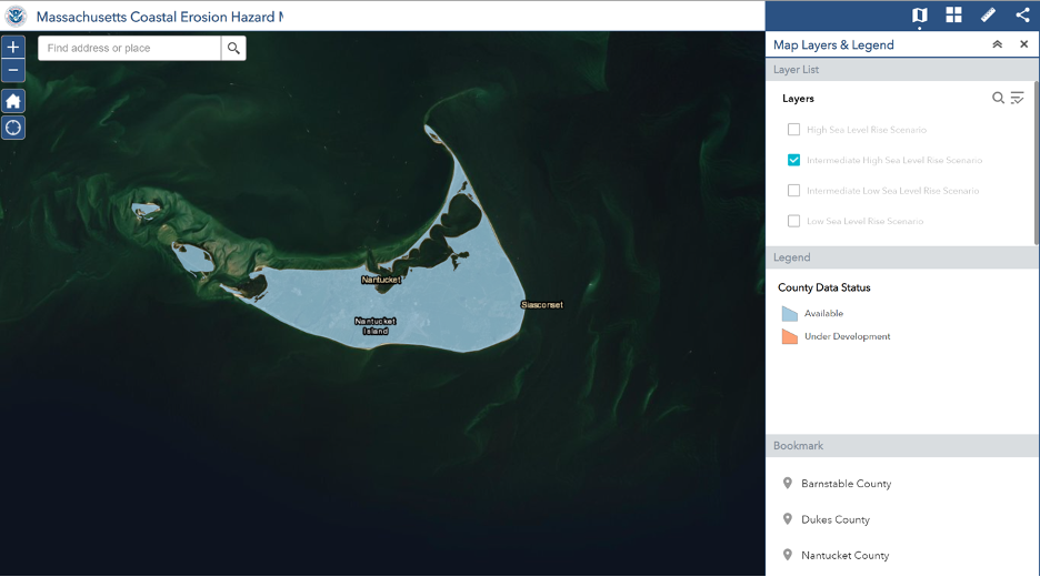
As much of a tremendous resource as these maps have been, especially the historic data, the limitation was something that wasn’t necessarily a forefront concern when they started back in the 1960’s. The maps, which date back to 1846, detail the one percent annual chance of a coastal storm event as well as actual historical levels (looking backward). Enter coastal erosion, 40 more years of knowledge and actual climate change. Coastal erosion maps provide additional risk assessments specifically focusing on the effects of sea level rise (3.57mm per year locally here on Nantucket).
Back in November Chuck Larson, Manager of Strategic Projects for the Town of Nantucket, shared a presentation utilizing this tool to estimate the combined effects of erosion and sea level rise. He illustrated that the mapping tool will help identify areas where coastal erosion could present as a hazard, plan future mitigation efforts and ultimately facilitate the reduction of future erosion risks.
The online mapping tool considers future, sea level rise scenarios (4) through the year 2100. They offer an additional tool (which also includes accretion projections) in the toolbox to look into the potential of what the future could like for all of us that love and live on our tiny little sandspit. The predicative years are 2030, 2050 (based off of receiving a 30-year mortgage), and 2100 to envision the physical state of the island in the next century.
Now, onto the maps and resources:
- Link to the coastal erosion and sea level map
- Directions:
- Head to the website
- Agree to the disclaimers
- Enter the address you are interested in learning more about
- NOAA recommends just turning on one scenario at a time so that your view does not get too muddled
- The website includes print and measuring options
- Here is a link to the public presentation as presented by FEMA and the Town Staff
- For those who want to learn more, here is a link to the Coastal Erosion Study as presented by FEMA for the entire Region 1, specifically Nantucket Island
- Link to traditional Flood Map Service Center as provided by FEMA
- Directions: